Successful land development requires comprehensive survey information at every project stage. From initial site assessment through detailed design to construction completion, different surveys provide the accurate data that informs decisions, prevents costly mistakes, and ensures developments proceed smoothly. Topo Surveyor supports developers throughout project lifecycles, delivering professional land surveying services tailored to each development phase.
This comprehensive guide explains which surveys land development projects need when, how survey data influences project success, and how strategic survey commissioning saves time and money while reducing risk. Whether you're developing a single house plot or a major mixed-use scheme, understanding survey requirements helps you plan effectively and avoid expensive surprises.
Pre-Acquisition Site Assessment Surveys
Before purchasing development land, savvy developers commission surveys investigating site characteristics that affect feasibility and value. These early surveys inform purchase decisions, reveal constraints that might necessitate price negotiation, and identify opportunities that enhance development potential. Investing survey costs during due diligence can save hundreds of thousands avoiding unsuitable sites or negotiating appropriate purchase terms.
Initial topographical surveys provide baseline understanding of site characteristics. The survey captures terrain levels revealing whether land is flat, sloping, or severely undulating. Steep sites increase foundation costs, complicate drainage design, and might require extensive earthworks reducing development viability. Boundary surveys define exact land extent, verifying that sites are as large as sale particulars claim and identifying any encroachments or disputed boundaries. Knowing precise site areas allows accurate density calculations essential for development appraisal.
Access surveys assess whether sites have adequate vehicular and pedestrian access meeting highway authority requirements. The survey measures existing access widths, visibility splays at junctions, and approach road characteristics. Poor access can render sites undevelopable or require expensive highway improvements that eliminate development profit. Early access assessment prevents committing to sites with intractable access constraints.
Utility surveys investigate service availability and connection feasibility. The survey identifies utility infrastructure positions and capacities, revealing whether electricity, water, drainage, gas, and telecommunications are available nearby or whether expensive infrastructure extension will be required. Development viability often hinges on connection costs—sites far from utilities might be uneconomical despite appearing attractive otherwise.
Contamination desk studies review historical maps and environmental databases identifying previous land uses that might have caused ground contamination. Former industrial sites, fuel stations, dry cleaners, or waste disposal areas frequently have contaminated land requiring expensive remediation. Desktop contamination assessments cost hundreds of pounds but can reveal tens or hundreds of thousands in remediation costs affecting site value dramatically.
Flood risk assessments determine whether sites lie within flood zones requiring flood risk assessment for planning permission. Properties in flood zones are difficult to insure and might require expensive flood mitigation measures. Early flood risk understanding informs development strategy or prompts reconsideration of acquisition.
Ground conditions investigation through trial pits or boreholes reveals foundation requirements. Weak ground, high water tables, or problematic soils significantly increase foundation costs. Knowing ground conditions before purchase allows accurate cost estimation and prevents nasty surprises during construction when foundation designs prove more expensive than assumed.
Planning Application Survey Requirements
Once sites are acquired, preparing planning applications requires several survey types providing information that planning authorities need for determination. Getting the right surveys commissioned at this stage prevents application delays and improves approval prospects.
Comprehensive topographical land surveys form planning application foundations. These detailed surveys capture all existing site features, terrain contours, boundaries, vegetation, drainage, and context necessary for architectural design and planning assessment. The survey extent should include adjacent land showing neighborhood context that planning officers assess when judging whether proposals suit their settings. Survey accuracy and detail must meet planning authority validation requirements—inadequate surveys delay applications while additional information is gathered.
Tree surveys following BS5837 standards are essential for sites with significant trees. Planning authorities increasingly require tree surveys demonstrating that developments protect valuable specimens and comply with tree protection policies. The survey categorizes trees by quality, calculates root protection areas, and informs tree protection plans that become planning conditions. Submitting applications without required tree surveys invites refusal or excessive conditions protecting all trees regardless of quality.
Ecology surveys might be required depending on site characteristics and local policies. Phase One habitat surveys identify whether sites have ecological features requiring detailed species surveys. Protected species like bats, newts, or nesting birds trigger survey requirements and sometimes necessitate mitigation measures or development restrictions. Early ecology surveys allow these issues to be addressed before detailed design, preventing late-stage surprises.
Heritage impact assessments apply to sites affecting listed buildings, conservation areas, or archaeological interest areas. These assessments require detailed measured building surveys documenting historic structures, research into heritage significance, and analysis of how proposals impact significance. Heritage surveys ensure developments respect historic character while achieving necessary improvements.
Transport assessments for larger developments require detailed access surveys, traffic surveys, and visibility assessments. Highway authorities scrutinize access arrangements carefully, and inadequate survey information invites objections. Comprehensive transport surveys demonstrate that developments provide safe, suitable access without unacceptable traffic impacts.
Drainage and flood risk assessments require topographical survey data showing existing drainage features and flow patterns. This information underpins drainage strategy design demonstrating that developments don't increase flood risk or overwhelm existing drainage infrastructure. Insufficient drainage information causes planning delays while authorities request additional details.
Detailed Design Stage Surveys
After planning approval, detailed design requires additional survey information enabling engineering design, construction planning, and building regulation compliance. These surveys build upon planning-stage information with greater accuracy and detail necessary for construction documentation.
Engineering surveys provide precise control networks that construction setting out references. These surveys establish coordinated points across sites using total station or GPS technology, achieving accuracy suitable for positioning buildings, services, roads, and infrastructure. Control network surveys create the framework ensuring all constructed elements end up in correct positions relative to boundaries, adjacent properties, and each other.
Utility surveys become critical during detailed design when services routing must be resolved. Comprehensive underground utility surveys using electromagnetic detection and ground-penetrating radar locate existing services that designs must avoid or connect to. Knowing exact utility positions prevents design conflicts requiring expensive revisions and helps contractors plan works safely around existing infrastructure. The survey identifies where utility diversions might be necessary and where connections can be made.
Drainage surveys investigate existing systems in detail. CCTV surveys examine pipe conditions, identify defects, and verify capacities. Manhole surveys measure invert levels and pipe arrangements. This drainage intelligence informs connection designs and reveals whether existing systems have spare capacity for new development or require upsizing.
Ground investigation extends site assessment-phase studies with detailed investigation supporting foundation and earthworks design. Boreholes or trial pits across sites sample ground conditions at proposed building locations. Laboratory testing determines soil properties affecting foundation design. The investigation might reveal ground improvement requirements or identify optimal foundation types for conditions encountered. Skimping on ground investigation to save survey costs commonly backfires when construction reveals unexpected ground conditions requiring expensive foundation redesign.
Dimensional control surveys for infrastructure ensure designs coordinate properly. Road construction requires precise level surveys ensuring drainage gradients work correctly. Sewer schemes need accurate surveys of existing invert levels for connection design. These detailed surveys prevent construction problems from dimensional incompatibilities between new and existing infrastructure.
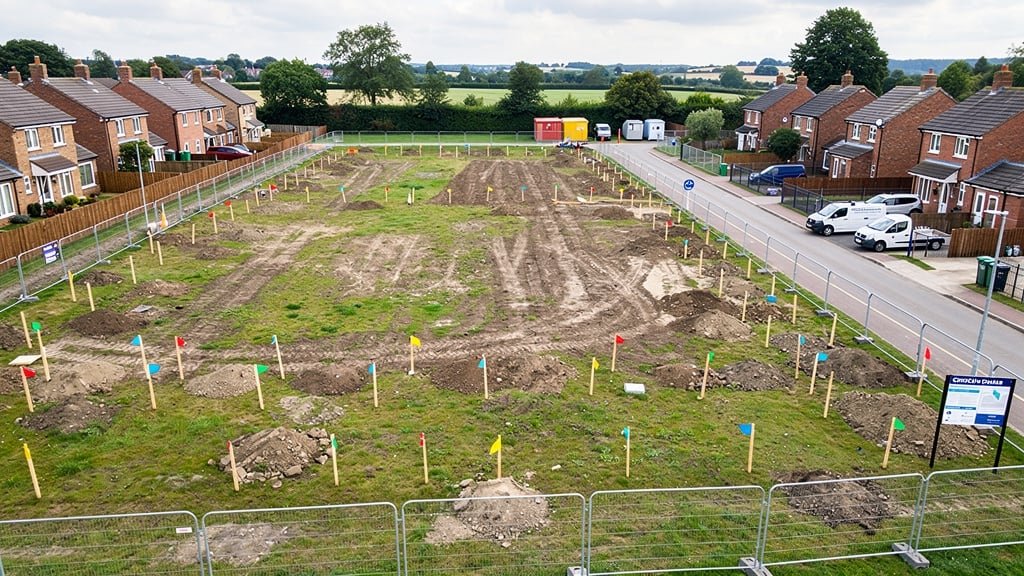
Construction Stage Surveying
During construction, ongoing survey support ensures works proceed according to designs and provides documentation for completion and handover. Construction surveying represents an often-overlooked aspect of land development that delivers significant value through error prevention and quality verification.
Setting out surveys transfer design positions from drawings to physical sites. Surveyors establish construction lines, excavation limits, foundation positions, column grid lines, and all other features requiring accurate positioning. GPS and total station technology enable millimeter positioning accuracy ensuring buildings and infrastructure construct in designed locations. Poor setting out causes construction problems ranging from buildings encroaching neighbors to drainage systems with incorrect falls.
As-built surveys document construction as completed rather than as designed. These surveys verify that buildings, roads, services, and landscaping were constructed in positions and to levels that designs specified. As-built documentation proves essential for future maintenance, modifications, or extensions when knowing exact positions of existing works becomes necessary. The surveys create records that buildings and infrastructure owners need for asset management.
Volume surveys calculate earthwork quantities for payment purposes. Cut and fill operations for site leveling or road construction require accurate volume measurement for contractor payment. Repeat surveys at intervals document excavation progress or stockpile volumes. Disputes about quantities can be avoided or resolved using objective survey data rather than estimates or guesses.
Monitoring surveys track building or ground movement during construction. Developments near sensitive structures might require settlement monitoring ensuring nearby buildings aren't damaged. Deep excavations need movement monitoring verifying that support systems perform adequately. Measured surveys at regular intervals document conditions, providing evidence of whether concerns are justified and triggering remedial action if problems emerge.
Drainage testing surveys verify that constructed systems work as designed. Post-construction CCTV surveys inspect pipes for defects before handover. Gradient checks ensure pipes have correct falls for self-cleansing. These surveys protect developers from future liability for defective drainage and satisfy building control requirements.
Completion and Handover Surveys
Project completion requires final surveys documenting what has been built and verifying compliance with approvals and specifications. These completion surveys provide records that developers, purchasers, and authorities need when projects transition from construction to occupation.
Completion topographical surveys show sites as finally constructed. The survey captures building positions, road layouts, service positions, drainage arrangements, boundary treatments, and landscaping. This completion documentation provides the baseline for future maintenance, modifications, or redevelopment. Building owners need accurate records of what they're acquiring, and completion surveys provide these records.
Verification surveys demonstrate compliance with planning conditions and building regulations. The survey might verify that buildings were constructed in approved positions, that sight splays achieve required dimensions, that parking provision matches approvals, and that landscaping was implemented as conditioned. This documentation satisfies discharge of condition requirements that planning authorities impose.
Service position surveys record exact locations of buried utilities, drainage, and infrastructure. These records prevent future excavation from damaging services and enable utility companies or building owners to locate systems for maintenance or connection. Comprehensive service records represent valuable assets that cost relatively little to create at construction completion but prove expensive to recreate later through excavation and investigation.
Floor level surveys verify that buildings achieve required floor levels and gradients. Building regulations require minimum floor levels in flood risk areas, gradients for disabled access, and level changes at fire compartment boundaries. Verification surveys document compliance preventing building control issues at occupation.
Boundary definition surveys establish developed site boundaries clearly. New boundary treatments might require marking on ground or recording on deeds. The survey provides definitive boundary positions preventing future disputes with neighbors or subsequent owners. For developments creating multiple properties or plots, boundary surveys define individual ownerships clearly from the outset.
Strategic Survey Planning for Developments
Successful developers think strategically about survey commissioning, recognizing that appropriate surveys at right times deliver maximum value while poorly-timed or inadequate surveys waste money or cause problems. Several principles guide strategic survey planning.
Early surveying reduces risk by revealing constraints before significant commitments. Site assessment surveys during acquisition due diligence cost little relative to potential savings from avoiding problematic sites or negotiating appropriate purchase terms. Planning-stage surveys commissioned early in design allow issues to inform layouts rather than forcing last-minute design changes when problems emerge.
Comprehensive initial surveys often cost less than multiple partial surveys. A thorough topographical survey capturing all site information might cost marginally more than minimal surveys but provides information useful throughout projects rather than requiring supplementary surveys later. Developers frequently commission additional surveys because initial surveys had inadequate scope—comprehensive surveys from the start avoid these inefficiencies.
Coordinating surveys with design stages ensures information availability when needed. Commissioning tree surveys months before planning applications leaves survey validity questions if trees grow significantly or storms cause damage between survey and submission. Timing surveys for delivery just before they're required keeps information current without causing program delays waiting for surveys.
Maintaining survey data properly through projects maximizes value. CAD files should be organized systematically, backed up reliably, and shared appropriately with project team members. Survey data represents valuable project assets worth protecting and exploiting fully. Developers who maintain good survey records find future phases or modifications proceed more smoothly than those who must commission new surveys because original data was lost or disorganized.
Building relationships with reliable survey providers yields better outcomes than always seeking cheapest quotes. Our land surveyor team becomes familiar with developer requirements, working styles, and quality expectations. This familiarity streamlines communications, reduces misunderstandings, and enables surveys that truly meet developer needs rather than merely satisfying minimum specifications.
Survey Costs in Development Context
Survey costs represent small fractions of overall development expenditure but deliver value far exceeding direct costs. A typical topographical survey costing one to two thousand pounds supports planning applications for developments worth hundreds of thousands or millions. The information that surveys provide reduces risk, prevents mistakes, and enables efficient construction—benefits multiplying survey investment many times over.
Developers should view survey costs as insurance against expensive problems. Inadequate surveys lead to design revisions, planning delays, construction surprises, and contractor claims—all costing multiples of original survey savings. Professional land surveying services from experienced surveyors using quality equipment costs more than quick surveys from inexpensive providers, but the reliability and comprehensiveness justify premium pricing through reduced project risk.
When evaluating survey quotes, developers should assess value rather than just price. The cheapest quote might reflect limited scope, inadequate accuracy, or inexperienced surveyors. Understanding what's included, what accuracy will be achieved, what deliverable formats are provided, and what support will be available helps compare quotes meaningfully. Sometimes mid-price providers deliver better value than either cheapest or most expensive options.
Conclusion: Surveys as Development Foundations
Land development projects proceed through multiple stages from site acquisition through planning, detailed design, construction, and completion. Each stage requires survey information appropriate to decisions being made and work being done. Strategic survey commissioning ensures required information is available when needed, supports informed decision-making, reduces risk, and enables efficient project delivery.
At Topo Surveyor, we provide comprehensive land surveying services supporting developers throughout project lifecycles. Our experience with development projects across the UK helps us understand what surveys developers need when and how survey data can be presented most effectively for development uses.
If you're planning land development and need survey support, get in touch with our survey experts. We'll discuss your project, recommend appropriate surveys for each stage, and deliver professional survey services supporting successful development.
Development Survey Services
We support land developers with comprehensive survey services from site assessment through construction completion, delivering the accurate data your project needs at every stage.
Get Comprehensive Development Surveys
From site assessment through construction completion, our survey services support every stage of land development. We provide the accurate data developers need for successful projects.